Map of central East Asia and Tibet with boundary lines marked with different colored pens from 1923.
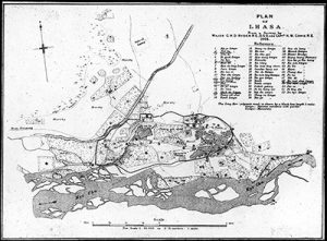
Map of Lhasa with certain names and places underlined and highlighted by hand in red pen; map taken from the survey map made by Major Ryder and Capain Cowie in 1904.